By Samuel J. Rob
“The following article was originally published in Harrisburg Magazine in 2023. Certain names, addresses, and links have been updated, but we have not edited any explanatory content, so some information about future plans is now outdated. This look at past planning reminds us of the complexities and unexpected challenges inherent to conservation and land use planning, and underscores the value of proactive efforts that protect conservation-based land uses in perpetuity. We are proud to share this brief introduction from an active member of our conservation community to illustrate the rich history and deep partnerships that drive our work.”
The Letort Regional Authority’s Letort Nature Trail in the Carlisle area packs a lot of history, scenery, and recreation into its short distance – and plans to get bigger and even better.
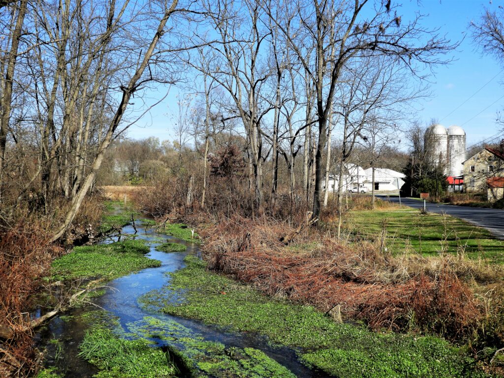
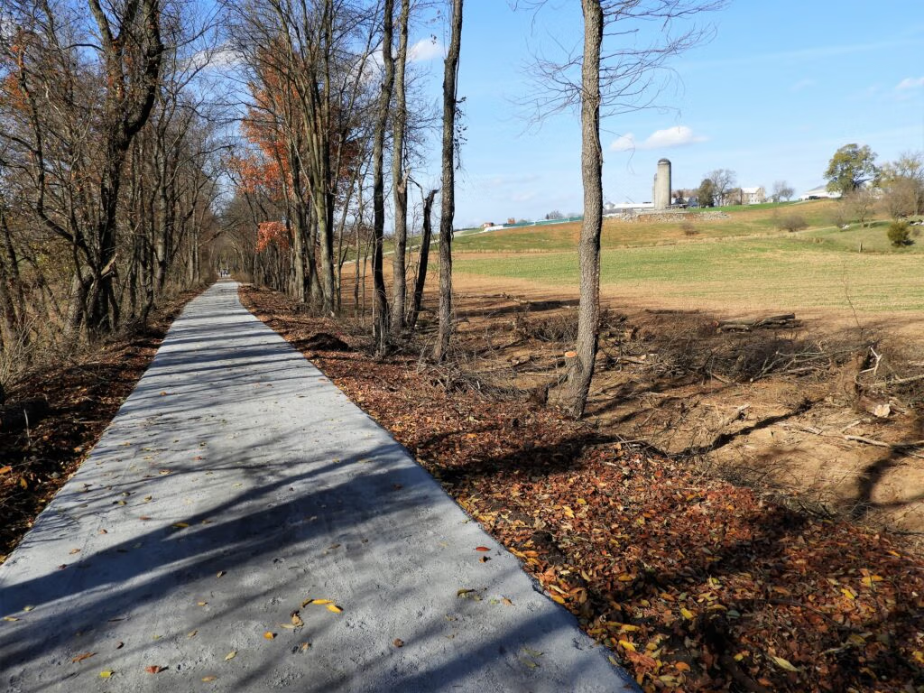
The Letort Nature Trail is a 4.5 mile long out and back multi-use trail that starts in Carlisle’s Letort Park and follows the meandering of the legendary Letort Spring Run, perhaps America’s most famous trout stream. The crushed stone surface (8 – 10 feet wide) follows the relatively flat roadbed of the abandoned South Mountain Railroad, offering trail users (bikers, hikers, walkers, birder watchers, fishermen, and, in winter, cross-country skiers) a pleasant outdoor experience, free of steep hills or rough ground (the trail is an American with Disabilities Act accessible trail, with a handicap accessible fishing platform located in Letort Park). Spread throughout the trail are benches and interpretative markers that tell the history of the trail, as well as information on the flora and fauna along the route.
The trail derives its name from the stream it follows, the Letort Spring Run, itself named after James LeTort (variously spelled Le Tort, Letort, or Letart). LeTort was a French-Swiss trader credited with being the first European settler west of the Susquehanna River in what is now Cumberland County. Letort received a license in 1712 to trade with the local Native Americans and chose to build his “trading post” (a collection of small cabins) at Beaver Pond (or Great Beaver Pond) close to a Shawnee village located near the headwaters of the Letort. The village and the proximity of several major Native American trails (Frankstown Path and the Great Trail) intersecting the area assured LeTort of a thriving business, though apparently his sharp business practices sufficiently angered the Shawnees such that they burned down the trading post in 1720. LeTort rebuilt his trading post, but, due to the influx of Scot-Irish settlers into the area, subsequently abandoned it and moved west in the late 1720’s. The exact site of LeTort’s trading post has never been discovered, but it is believed by most local historians to have been located off the East Branch of Letort Spring Run, likely in the area that later became a commercial watercress farm. This would have eradicated any archaeological evidence of the trading post.
While James LeTort would fade into history, the stream that bears his name would go on to become the cradle of modern fly fishing in America. While only nine miles in length from its source near Bonnybrook Road to its mouth at Conodoguinet Creek, the Letort, its crystal-clear waters enriched by limestone springs, harbors a healthy population of wild and wily brown trout that feed on the stream’s abundant aquatic insects and hide in its lush watercress and elodea vegetation. The stream was made famous in the 1950’s and 1960’s by legendary fly fishing writers, Vince Marinaro (“The Modern Dry Fly Code” and “In the Ring of the Rise”), Charlie Fox (“The Wonderful World of Trout” and “Rising Trout”), and renown fly tier, Ed Shenk, who created the ubiquitous Letort Cricket and Letort Hopper fly patterns. In 1981, the use of pesticides on the commercial watercress farm on the stream’s east branch resulted in a large fish kill, but the trout population has since rebounded. The Letort is classified as a Class A Wild Trout Stream and 1.7 miles of the stream.is restricted to fly fishing with barbless hooks only and all fish caught must be released. The Letort is also designated as a Pennsylvania Scenic River as well as Exceptional Value Waters.
While the Letort Spring Run is the trail’s main attraction, the Central Pennsylvania Conservancy’s (CPC) Letort Spring Garden Preserve is a great place along the trail to stop, relax, and learn about environmental stewardship. The 34 acre preserve is located on the site of the now defunct watercress farm whose origins go back to the 1890’s. While the Preserve’s most notable features are the 1881 Melester Bank Barn (listed on the National Register of Historic Places) and a restored 1820 springhouse, the observant eye will quickly spot red-winged blackbirds, ducks, deer, and other wildlife drawn to the wetlands. The Preserve is an ideal location for carrying out the CPC goals of ecological restoration, history interpretation, and conservation education. The CPC is working to improve accessibility, through parking improvements and trail updates, in conjunction with community partners. The project is slated for completion in 2024.
While the commercial watercress farm has ceased operations, industry is still present along the trail. More than one trail user has been startled when coming upon a large active limestone quarry operation in the midst of such idyllic surroundings. The juxtaposition of quarry, stream, and trail serves as a reminder of the balance planners strive for in juggling recreation, conservation, and preservation in an urban setting.
Once back in Carlisle, take time to eat, drink, and explore the town voted last year as America’s #4 Best Historic Small Town in USA Today’s 10Best Readers’ Choice Awards. For dining and lodging options, go online to the Cumberland Valley Visitors Bureau website (https://www.visitcumberlandvalley.com).
Trail Access Points:
Letort Park (located off East Pomfret Street in Carlisle)
Letort Spring Garden Preserve (1110 South Spring Garden Street)
Heisers Lane (small gravel parking area at the current southern trail terminus)
A map and descriptions of the trail can be found online at the Letort Regional Authority’s website (https://letort.org) or on Rails-to-Trails Conservancy’s TrailLink website (cvrtc.org).